Sunday, 18th July 2021

I couldn’t for love nor money find any accommodation for the Saturday AND Sunday nights but I did manage to find somewhere for the Sunday night which meant I had to be up at stupid-o’clock that morning in order to get there and have a full day. I can cope with that, so long as I don’t have far to drive afterwards when I’m tired.
I arrived at the Swirls car park and was pleased to see this:
 |
| Pay and display machine out of order |
I was also pleased to see the toilets open, curiously with no sinks, just a couple of dispensers with sanitiser in. Not sure if it’s always been like that – it certainly didn’t look “newly installed”.
Anyway, this also gave me the opportunity to suss out my exit out of the car park which was just to the right of the toilet block. My plan being to head along the permissive path through the forest to Wythburn to wake my legs up – a nice, gentle warm up:
 |
| Permissive path |
It reminded me of the tiny bit of the West Highland Way that I did a few years ago.
It was quite lumpy and bumpy and was teeming with wildlife – birds chirruping away, squirrels and the most ENORMOUS dragonfly I’ve ever seen:
 |
| 5 inch long dragonfly |
Pootling along through the trees and suddenly, a view:
 |
| Thirlmere through the trees |
A bit further along and this curious building:
 |
| Castle shaped building |
I think it’s part of the water board’s gubbins but, nevertheless, impressive.
After a couple of miles I found a bench so decided to stop for Snack Stop Number 1:
 |
| Bench |
 |
| Snack Stop Number 1 |
Not a bad view at all.
There were lots of folks canoeing on Thirlmere. I really must look into doing that again sometime soon.
A little further along and it’s time to head upwards:
 |
| Stone steps at Wythburn |
Oh yes, those of you who’ve never been this way will be thinking “that doesn’t look very steep” and, like all good man-made paths, it lulls you into a false sense of security. Just out of shot and for the rest of the way up it is STEEP and not all of it is as well maintained as this. I’m glad I went up this way.
Lovely little waterfall on Whelpside Gill:
 |
| Unnamed waterfall |
Not marked on the map. Comb Gill didn’t really have any water in it. I think these gills are “harvested” by the water board and funnelled into Thirlmere and I’d passed their manmade, forced boulder-cobble walls on the permissive path so seeing them wild and untamed was lovely.
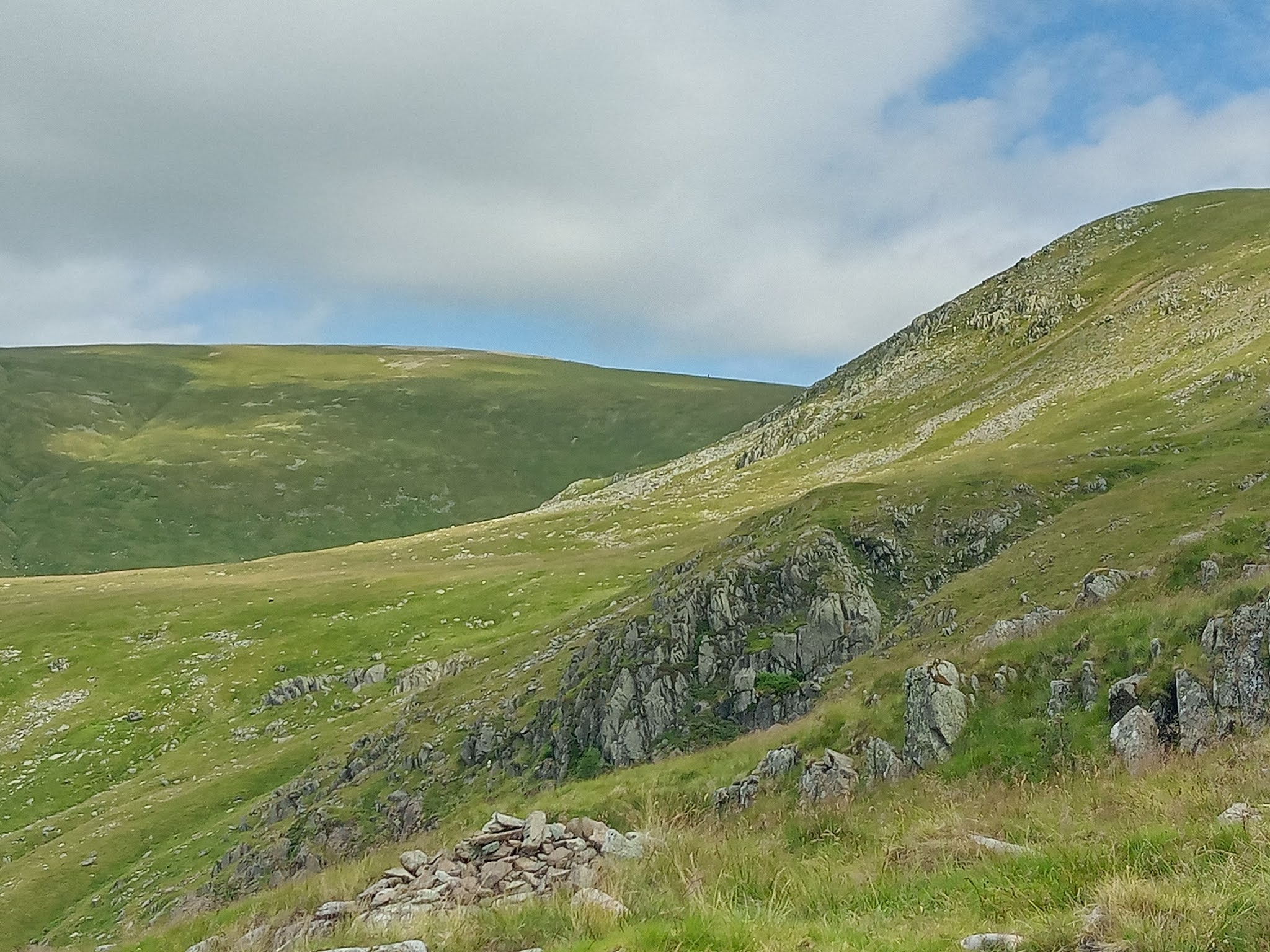
Approaching some craggy stuff:
 |
| Comb Crags (possibly) |
Comb Crags, I think. I was looking forward to getting to the top of those and the gradient easing off a bit. Not that I really noticed once I’d got there, if truth be told.
My legs still hadn’t quite got the idea that I was walking uphill and I just couldn’t get into a rhythm so I was very much stop-start-stop. Err, I mean, I made the most of admiring the fantastic views.
I kept getting cramp in the sides of my calves too, which kept running down to the tops of my feet. Time for a bit of shoe adjustment – perhaps my laces were too tight? Made no difference so I perched on a boulder and did some yoga stretches.
A last glimpse of Thirlmere before I rounded the corner into oblivion:
 |
| Last view of Thirlmere |
And my destination in the distance:
 |
| Helvellyn - the flat looking hill on the left |
It looked a very long way away!
Looking back down the zig-zag path from the top of High Crags (I think):
 |
| Looking back down the zig-zag path |
It really does look rather gentle doesn’t it? I didn’t think it was gentle at all. I thought it was all flippin' steep so far.
The views behind me from this way up were absolutely fantastic. I think I could see Morecambe Bay in the distance to my left and I think I could see Scotland to the right and the whole of the Lake District in between.
There were a few hang-gliders around:
 |
| Hang-gliders |
 |
| .. and another |
I know they launch off Clough Head. One or two of them seemed to get very near to the ground before veering off into the void after catching a thermal. I don’t think I’ll be having a go at that anytime soon. I bet the views are amazing from up there though.
Another quick snap of my destination as I near Nethermost Pike:
 |
| Helvellyn in the distance (far left) |
And it was about now that I realised that (a) Nethermost Pike is a Wainwright too and (b) this path doesn’t actually take you there. So for the sake of a few hundred metres of off piste-ness, off up the hillside I went. I actually found this to be the easiest bit of the walk. A nice grassy hillside where I could pick my own line and put my feet where I wanted them to be.
I reached what I thought was a cairn but it turned out to be a kind of tumbled down shelter with not a great deal in the way of views. So I pottered off towards another cairn over to my left.
And then, ooooOOOooohhh:
 |
| Striding Edge |
Teeming with people-beetles. Nutters!
Not for me, ain’t that!
Anyway, this ‘ere cairn had rather a nice flat stone plinth on its eastward side and I had it all to myself. I felt a Snack Stop Number 2 kind of urge:
 |
| Snack Stop Number 2 |
Freshly fortified with honey roasted nuts, my next destination needed no route-finding or navigation skills whatsoever:
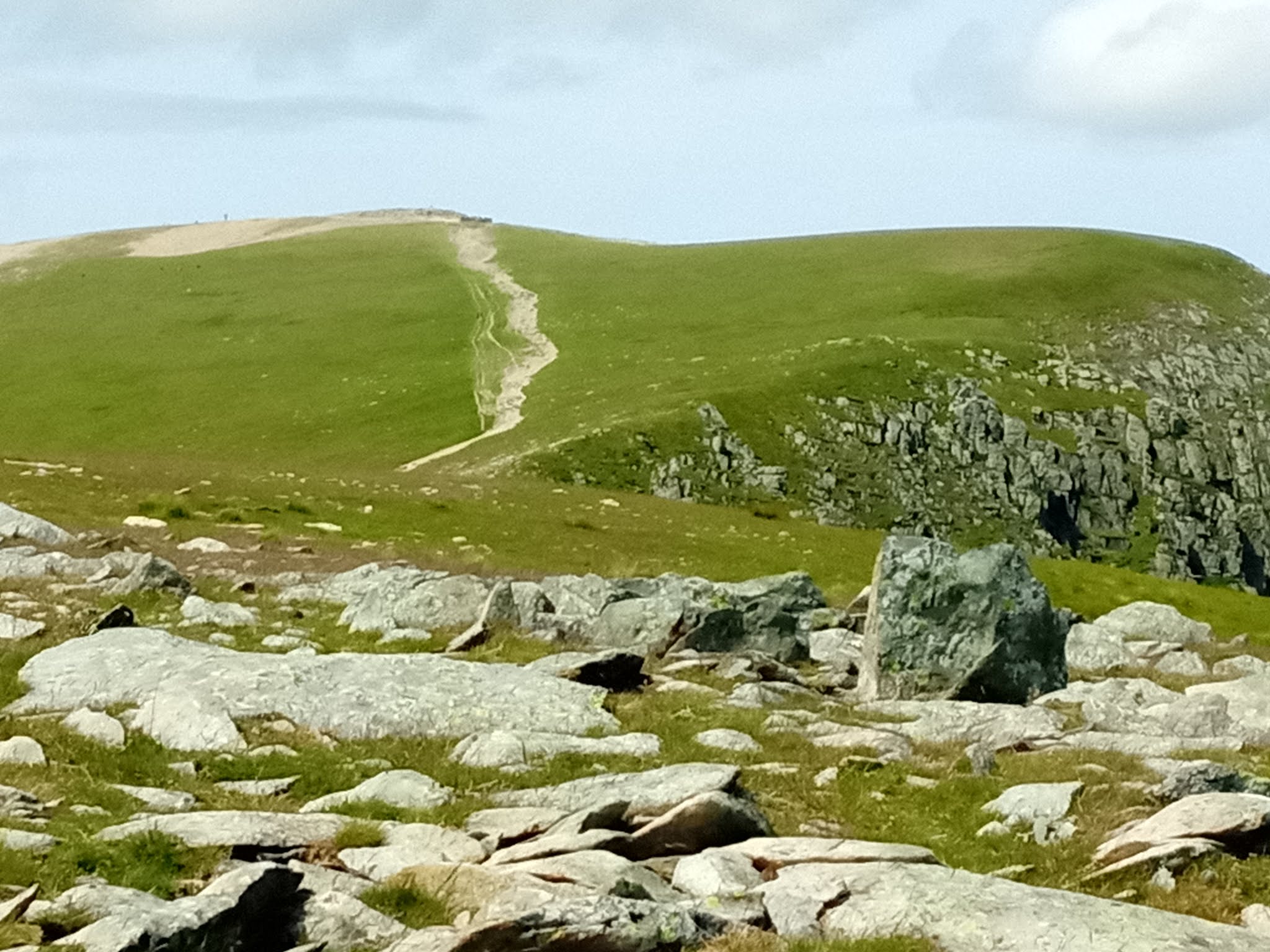 |
| The Helvellyn "motorway" |
A little marker-stone for a successful landing of an aeroplane on this spot in 1926:
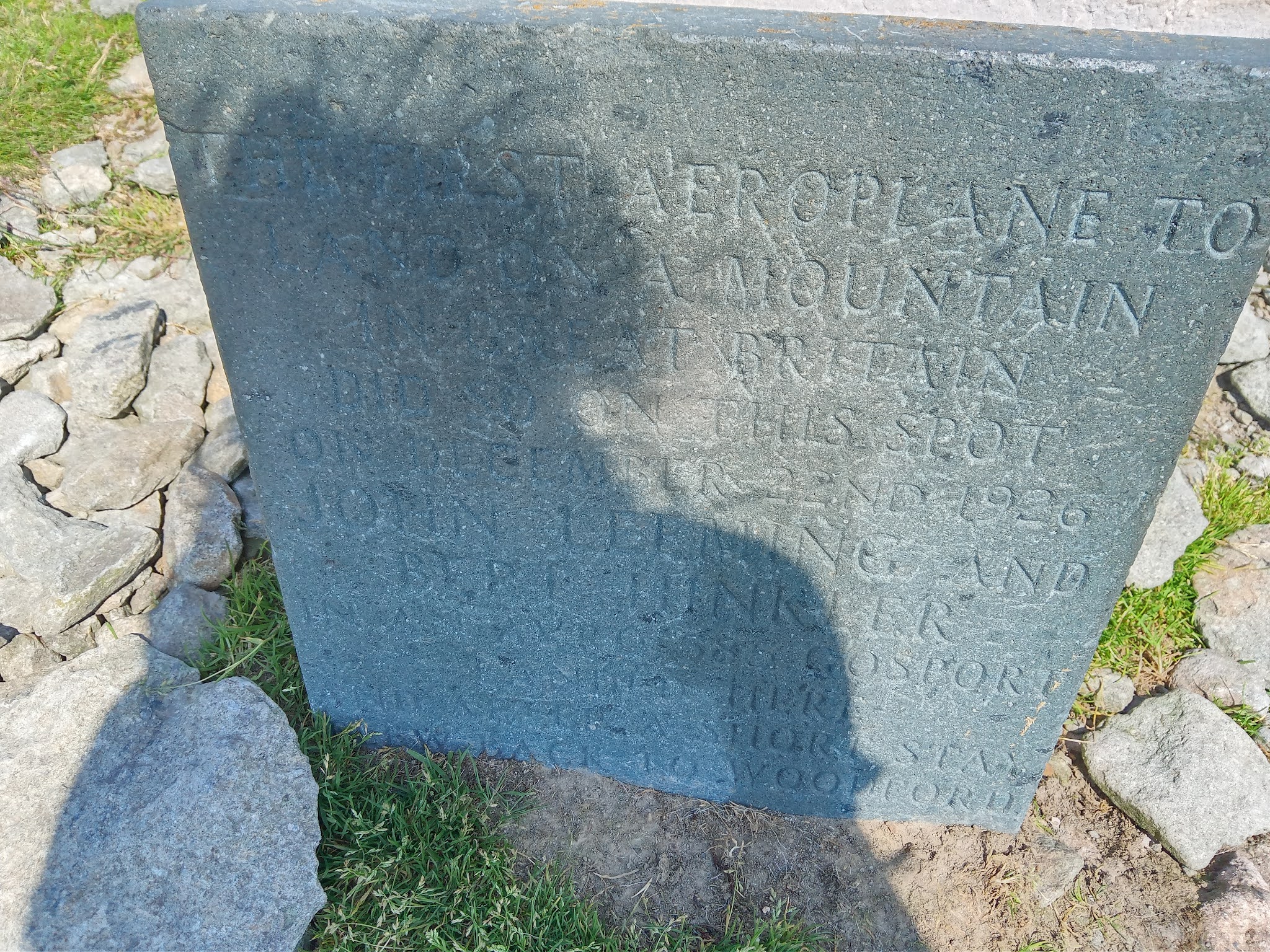 |
| Marker stone |
My Shadow Monster could have brushed its hair!
And then, hoorayyyy (well almost). I didn’t take any pics of the summit shelter as it was full of people and I had to almost queue to be able to get this pic:
 |
| Red Tarn looking very blue! |
Nor did I take a pic of the other memorial stone. Honestly, the place was heaving.
And more people-beetles on Swirral Edge:
 |
| Swirral Edge |
I get to the trig to officially bag Helvellyn:
 |
| Helvellyn - bagged! |
 |
| Red Tarn again |
There were actually people on the little jutting out bits of the tarn. I can imagine it was baking hot down there and they were probably having a swim!
I had a little peep over the edge at Swirral Edge:
 |
| Swirral Edge |
(apologies for the finger)
I’d maybe consider this in ascent. Yikes! Did I really just say that?
As I was looking down, a couple of people popped their heads up with sparkly eyes and huge grins on their faces. It would have made a great photograph from my viewpoint.
Seeing as Helvellyn was hugely busy, I decided Snack Stop Number 3 would be more enjoyable a bit away from the crowds. I found a lovely spot just before the col between Helvellyn and Lower Man:
 |
| Snack Stop Number 3 |
Brown Cove and Catstye Cam with Ullswater in the distance.
The sun on my back and out of the wind, and silence. Hard to believe such a thing is possible on a blustery sunny summer Sunday on a very popular mountain. I watched the people-beetles on Swirral and spotted a few stick insects on top of Catstye Cam. I also spotted what looks like a (very eroded) path leading from the dam wall up the side of Catstye Cam. There’s nothing marked on the map but there is a definite, faint zig-zag line up the western nose. Clearer in reality than on the pic.
I sat and umm-ed and ahh-ed a bit as to what route down to take. I was feeling in fine fettle now so I decided to head over the nose of Lower Man and to Whiteside Bank. Except, after the descent off Lower Man I sacked that idea off. I didn’t like the descent off Lower Man at all, not in the slightest. Horrible, steep, narrow, loose, pebble-fest. So, instead I decided to take the (alleged) path off to the left. Now, I either undershot that path (well I definitely did according to my track recording) but I never found it anyway despite my track recording showing that I crossed it.
And so began a recce for a Karl’s Kut Price Tours route. By now, I’d decided that the path didn’t exist and I was on steep, rough, grassy, pathless ground:
 |
| The never-ending steep, grassy hillside |
After a bit of bum-sliding down the grassy hillside, I followed the upper prong of Helvellyn Gill and apparently crossed the path that runs to the right of Piketoe Knott. I’m sure I never found that one either. I crossed the lower prong of Helvellyn Gill:
 |
| Lovely little stream |
I crossed a tumbledown wall and then spotted people coming down what I assumed was the Browncove Crags path so I aimed in that general direction.
I was very pleased by this point to be back on an actual path. Another stone-stepped path:
 |
| Another steep, stone stepped path |
My delight was short lived as it got steeper and my legs got more tired.
The sun, by now, was fully out and blazing down on me, head-on. I found a bit of shade and had Snack Stop Number 4. No pic of this because a chap passed me and started chatting, telling me he’d lost his hat up on Helvellyn. He did look rather pink! He said he’d run out of water so I gave him some of mine.
I also passed some mountain bikers carrying their bikes up. They’d passed me earlier, on my way up. This was apparently their fourth round today. FOURTH round!! Good effort!! Raving mad nutters!
This stone path went on for EVER. And it too, didn’t follow the path marked on the map! I’m glad I came down this path though as I really wouldn’t have fancied going down the one I came up.
If you can have the opposite of a false summit this path is it. So many times I thought “there’s the woodland where my car’s parked – so just down this next bit and round the corner and I’m done” and so many times I got down the next bit and round the corner and saw endless more stone going down a bit and round a corner.
And then:
 |
| A little, fenced off waterfall |
Oh how I wanted to just sit and paddle my feet in that but it was all fenced off.
And finally, a finger board. I never spotted one at the start of my walk.:
 |
| Signpost to Helvellyn |
I got to my car and sat a while in the shade for Snack Stop Number 5 and a cuppa – I’d brought my folding camping chair especially for this purpose.
Then I headed off to my accommodation for the night where I downed a pint of orange squash all in one go, stuffed my face with more food – I really don’t understand how starving I was considering I trickle-fed all day! Then, The Best Shower Ever before discovering the true meaning of bliss and contentment as I laid on the bed and stared at the ceiling, my mind still up in the mountains. And before I knew it, I was asleep. Perfect.
3,117 foot of mountain and 9.6 miles. It took me all day and I loved every leg-aching minute of it.
Although the next day I ached, considering this was a big toughie for me, I’m surprised I didn’t ache more. I love that feeling anyway. Sign of a good day in the hills, me thinks.
I want more!
Thanks for reading.